Log in
All resources
Create a design
1,565 Free Images of Mercator Projection
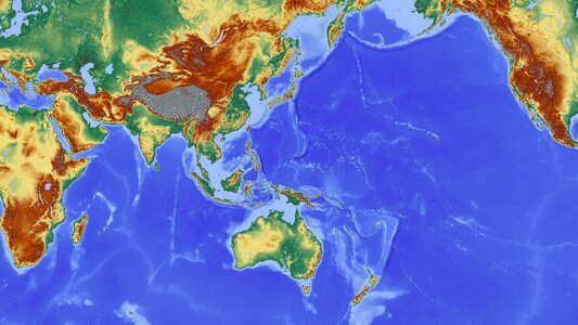
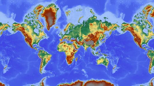
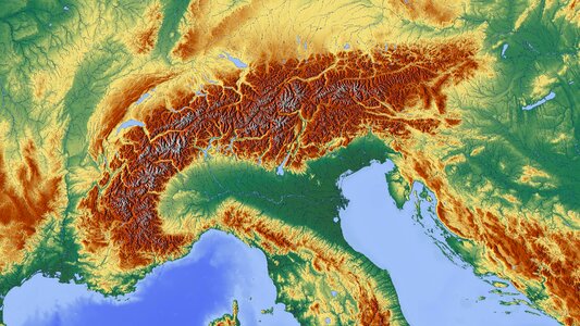
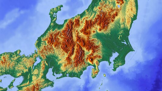
maps
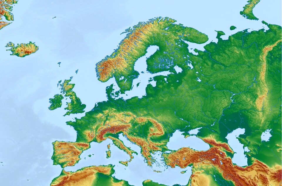
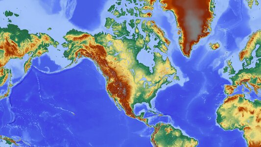
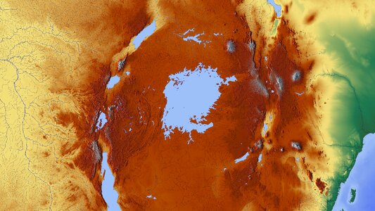
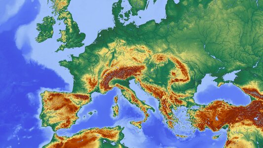
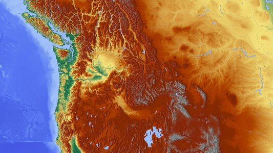
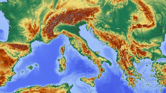
relief map
bibliothèque nationale de france
cartography
high relief
topography
height structure
color
shade
elevation map
atlas sive cosmographicae (gerardus mercator, 4th edition 1613)
maps of provence by pierre-jean de bompar
atlas sive cosmographicae (gerardus mercator, 1607)
maps of île-de-france by françois de la guillotière
atlas sive cosmographicae (gerardus mercator, 1630)
maps of liège by baptista van doetecum
atlas sive cosmographicae (gerardus mercator, 4th edition 1613)
maps of the magellan straits by lambert cornelis
atlas sive cosmographicae (gerardus mercator, 1630)
maps of île-de-france by françois de la guillotière
atlas sive cosmographicae (gerardus mercator, 1607)
maps of liège by baptista van doetecum
maps of franconia by gerardus mercator
1640s maps of bavaria
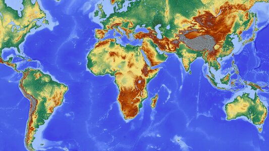
africa
maps
cornell: persuasive cartography: the pj mode collection
cornell university library
atlas sive cosmographicae (gerardus mercator, 4th edition 1613)
maps of east flanders by pieter van der keere
background
maps
atlas sive cosmographicae (gerardus mercator, 4th edition 1613)
maps of île-de-france by françois de la guillotière
atlas sive cosmographicae (gerardus mercator, 4th edition 1613)
maps of liège by baptista van doetecum
atlas ou representation du monde universel t. 2 (1633)
maps of bohemia by gerardus mercator
atlas minor gerardi mercatoris (1609)
maps of asia by mercator-hondius
media contributed by university of illinois urbana-champaign university library
maps of guinea by mercator-hondius
media contributed by university of illinois urbana-champaign university library
maps of morocco by mercator-hondius
media contributed by university of illinois urbana-champaign university library
maps of abyssinia by mercator-hondius
media contributed by university of illinois urbana-champaign university library
maps of morocco by mercator-hondius
eran laor cartographic collection
old maps of canaan
atlas ou representation du monde universel t. 1 (1633)
maps of england by gerardus mercator
dutch 17th-century prints in the rijksmuseum amsterdam
war of the jülich-kleve succession
maps in the rijksmuseum amsterdam
maps by frederick de wit
atlas maior, vol 1 (northern europe, norway, and denmark) - joan blaeu, 1667 - bl 114.h(star).1
17th-century double hemisphere world maps
atlas ou representation du monde universel t. 1 (1633)
17th-century double hemisphere world maps
atlas maior, vol 6 (scotland and ireland) - joan blaeu, 1667 - bl 114.h(star).6
maps of idrone by gerardus mercator
cartography
maps
india
maps
maps of denmark by gerardus mercator
historical coats of arms of denmark
atlas maior, vol 2 (sweden, russia, poland, eastern europe, and greece) - joan blaeu, 1667 - bl 114.h(star).2
maps of slavonia by gerardus mercator
atlas maior, vol 2 (sweden, russia, poland, eastern europe, and greece) - joan blaeu, 1667 - bl 114.h(star).2
maps of candia by ortelius and mercator
cartography
maps
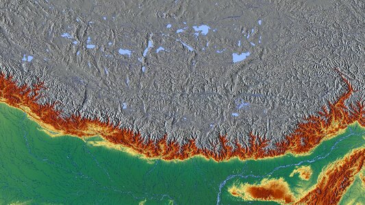
mountain
maps
atlas, ou représentation du monde universel et des parties d'icelui, faicte en tables et descriptions très amples et exactes, divisé en deux tomes. édition nouvelle... - btv1b53103889w
maps of guinea by mercator-hondius
atlas, ou représentation du monde universel et des parties d'icelui, faicte en tables et descriptions très amples et exactes, divisé en deux tomes. édition nouvelle... - btv1b53103889w
maps of waldeck by gerardus mercator
atlas, ou représentation du monde universel et des parties d'icelui, faicte en tables et descriptions très amples et exactes, divisé en deux tomes. édition nouvelle... - btv1b53103889w
maps of the peloponnese by gerardus mercator
atlas, ou représentation du monde universel et des parties d'icelui, faicte en tables et descriptions très amples et exactes, divisé en deux tomes. édition nouvelle... - btv1b53103889w
maps of candia by ortelius and mercator
africa
maps
australia
maps
earth
maps
mountain
maps
mountain
maps
africa
maps
mountain
maps
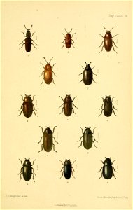
entomology
beetle
arago (lunar crater)
ariadaeus (crater)
romanticism,orientalism
ameghino (crater)
ptolemaeus (crater)
lac-77
mountain
maps
naonobu (crater)
atwood (crater)
cartography
maps
berosus (crater)
hahn (crater)
wolf (crater)
lac-94
russell (lunar crater)
struve (crater)
trouvelot (lunar crater)
rilles of the moon
aliacensis (crater)
walther (crater)
egede (crater)
lac-13
piazzi smyth (crater)
mons piton
2-view orthographic projections of flying wing aircraft
josé weiss
2-view orthographic projections of flying wing gliders
josé weiss
alexander leo soldenhoff
gottlob espenlaub
2-view orthographic projections of flying wing aircraft
alexander leo soldenhoff
2-view orthographic projections of flying wing aircraft
alexander leo soldenhoff
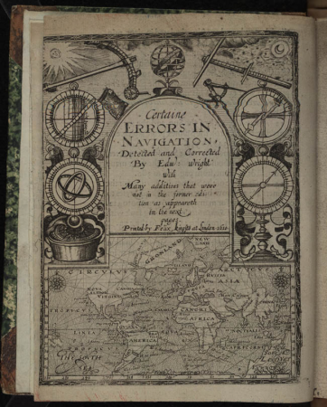
books by edward wright
1610 books from london
maps by edward wright
molyneux globes
1501 - 1565 of 1,565
/ 16


![Gerardi Mercatoris and I. Hondii Atlas or Representation of the Universal World, and of the Parts of It, Made in Tables and Very Ample Descriptions. [t. 2].](https://cdn.creazilla.com/illustrations/10000238363/gerardi-mercatoris-and-i-hondii-atlas-or-representation-of-the-universal-world-and-of-the-parts-of-it-made-in-tables-and-very-ample-descriptions-t-2-sm.webp)


![Gerardi Mercatoris and I. Hondii Atlas or Representation of the Universal World, and of the Parts of It, Made in Tables and Descriptions Very Ample, and Exact: Divided into Two Volumes [...]. [t. 1].](https://cdn.creazilla.com/illustrations/10000720637/gerardi-mercatoris-and-i-hondii-atlas-or-representation-of-the-universal-world-and-of-the-parts-of-it-made-in-tables-and-descriptions-very-ample-and-exact-divided-into-two-volumes-t-1-sm.webp)


![Gerardi Mercatoris and I. Hondii Atlas or Representation of the Universal World, and of the Parts of It, Made in Tables and Descriptions Very Ample, and Exact: Divided into Two Volumes [...]. [t. 1].](https://cdn.creazilla.com/illustrations/10000622971/gerardi-mercatoris-and-i-hondii-atlas-or-representation-of-the-universal-world-and-of-the-parts-of-it-made-in-tables-and-descriptions-very-ample-and-exact-divided-into-two-volumes-t-1-sm.jpg)